Friday, October 3, 2014

Day 35 Mile 4,477.9 Home


After every wonderful adventure, the hills of Clayton County always look beautiful and inviting. We got home about noon on Wednesday October 1 which was not a coincidence, since it was men's day and my foursome teed off at two. The house survived admirably, with no furnace, water or sewer problems. Even our prairie seemed to greet us, with the big blue stem waving Hello and a bunch of purple Asters blooming.  After how many years of trying to start them, the effort paid off.


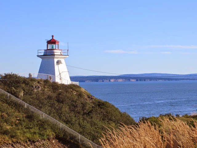
We return with many wonderful memories; of rocky coastlines, lobster nets, Niagara Falls, the Erie Canal, and best of all, so many kind people.


I was probably most impressed with the history and engineering of the Erie Canal, especially the locks. Seeing a cruise ship drop forty feet in just a few minutes was a treat.  But maybe best of all was the seafood - great quantities of lobster, scallops, haddock, and much more, apparently harvested in a sustainable manner, with strict seasons and limits.


The biggest surprise for me was the accessibility and busyness of Acadia National Park.  I naively expected it to be in the wilderness of northern Maine, a bit like the Boundary Waters.  In fact it is the second busiest park in the country, and is within a day's drive of twenty five percent of the population of North America.  Thankfully, it was preserved when it was and stands as a very visible sign of the wisdom of protecting such unique and beautiful places.


Finally, and most impressive to me was the kindness of the Canadian people we met.  Everything seems substantially more expensive there; the taxes are sky high; and they remain laid back and outwardly happy.  Many people were very helpful when we were lost or needed something, and seemed to go out of their way to assist us.  In addition, almost every town had a tourist information center with a staff that would not only give us ideas about what to do and see, but who volunteered to call and make reservations when necessary.


Life on the road is always unpredictable and who knows where we will go next time, so stay tuned.  Thanks for sharing our adventure.


John and Sue

Sunday, September 28, 2014

Day 29 Mile 3254.1 Herkimer NY Erie Canal


"I’ve got an old mule and her name is Sal, fifteen miles on the Erie Canal”
After two nights of camping at a beautiful spot in Herkimer, NY, we have a new appreciation and understanding of the Erie Canal.  At a time when the trip over the Appalachian Mountains could take weeks, two lawyers engineered the idea of a canal roughly following the channel of the Mohawk River.  


Started in 1817, and completed in 1925, the canal was constructed entirely without any professional engineers. The two men behind the project actually were New York lawyers. It stretched from Buffalo, on Lake Erie, to Albany, on the Hudson River, and provided a pathway to the West for thousands of pioneers. The route from the Atlantic Ocean to the Great Lakes took only nine days, where the old overland freight route took up to 45 days. I could go on and on, but it's a wonderful example of American ingenuity and 19th century technology. 


The town of Herkhimer is right on the old canal, so we took our bikes to town and rode about 25 miles on two of the trails, some of which were part of the old tow path right next to the water. The old canal is gone, but a modern one, which uses a good portion of the Mohawk River, still allows boats to make the trip.  We saw two sailboats with their masts down and lashed to the hull, and a cruise ship, which started in Montreal and was headed to New York City.


The cruise ship went through the lock at Little Falls while we were there, a drop of forty feet. It was a very impressive sight.  One of the crew members jumped off the boat, fed two lines from the lock to the ship as it descended, and when the lock opened down below, he sprinted down the edge of the lock, hurdled the steel gate, and ran down the steps on the other side, just in time to jump back on as the ship emerged. 

Herkimer New York near the Erie Canal.   

Afterwards, we even had time for coffee at a local shop before we headed back to the campground.  It was a good couple of days, and we both have a new admiration for the canal and it's builders. We are in a campground about 60 miles north of Columbus tonight in Butler, Ohio, and then off to Indianapolis tomorrow to watch some football and the Ryder Cup golf matches with Betsy and Joe.

Herkimer New York.   

A final note on the ferry ride from the last blog entry.  We were an hour late because of high seas and strong headwinds.  Much nicer on a large boat than driving for two days on curvy roads.  The ferry was very nicely appointed, but not many passengers were on board, so it was weird to walk the mostly empty decks.  The casino was open for most of the trip, and we might have seen two people playing the slots, with nobody at the blackjack and poker tables. The ferry company must be losing money big time, but for us it was a very relaxing and enjoyable trip.
  

Wednesday, September 24, 2014

Days 23-27 Mile 2885.4 Halifax


Halifax Farmers' Market.   


Halifax is a thriving seaport on the southern coast of NC with a long, colorful history. The Cunard Line of shipping and passenger vessels began here, and we spent a good three hours in the maritime museum on the waterfront. Cunard began with fishing boats and expanded to shipping and passenger vessels, and from sail to steam to diesel. The locals have always been tied closely to the sea and were directly involved in the rescue of Titanic survivors.  We also learned about a horrible explosion of a munitions ship in 1917 which killed thousands and completely leveled a good portion of Halifax.

Charity Golf promo on the Halifax wharf. Can you hit the green?  


Today, it's a cosmopolitan city with a thriving seaport and lots of tourists.  The Queen Mary II was in port, so along with the tour buses, there were lots of folks strolling along the boardwalk and visiting all of the shops, restaurants and galleries that dot the waterfront.  Luckily, we were there on Saturday morning to visit the farmers’ market.  It's all inside a huge pavilion and is about the size of the market in Minneapolis.  Lamb, seafood, fruits and veggies, herbs, food shops from Chinese to hot dogs, and too many craft and gift shops to mention.


Peggy's Cove.   


The next morning it was off on the coastal highway to Peggy's Cove and Lunenburg.  The drive was pretty, and the coastal towns are very nice; although, they did seem all alike after about number ten.  Just west of Peggy's cove is a small memorial to the passengers lost on Swiss Air flight 111.  It's only a couple of granite stones but very moving and marks the closest spot on land to the crash site.
Coffee Break at Peggy's Cove.   


Peggy's Cove Lighthouse.   


Lunch break on the way to Lunenberg.  


Driving back to the campground that night, the rain began, and we had an all night storm with a deluge of rain and strong winds.  The B rocked, but no leaks.  When the storm subsided, it was replaced by a high-pressure system with strong northwest winds expected…to continue for two or three days.  

Lunenberg.  

Bluenose II at Lunenberg.   

Ferry from Yarmoouth NS to Portland ME.   


I really am a wimp when it comes to driving the B in wind, so we looked at alternatives and found this ferry.  It travels between Yarmouth and Portland, with one round trip per day.  Our ride is about ten hours, leaving NS at ten this morning, and with the time change, arriving in Portland at seven tonight (except the ferry was an hour late). 


I estimated the cost of gas to drive all the way back through Nova Scotia, and New Brunswick, and the total cost was about the same. (Except the only comfy seats with upholstery are an extra $25 bucks each). So we are about 2 1/2 hours into the cruise and relaxing in our nice reclining chairs. 
Yarmouth, NS.   


Outside it's sunny but very cool and windy, so the decision seems to be correct.  Tonight we have reservations at a campground just outside of Portland, and then we head west, hopefully to camp along and ride our bikes on the Erie Canal trail.

Thursday, September 18, 2014

Day 21 Cabot Trail Loop of 180 miles around Cape Breton Nova Scotia


Yesterday it was off on the grand tour of the Cabot Trail, named after John Cabot, who was on a mission of exploration for the King of England.  His real name was Giavonni Cabotti, but neither the Italians nor the Portugese would sponsor him, thus the change in name and allegiance. 
 

It is about a 300km drive around the northerly tip of the Nova Scotia peninsula, with breathtaking views, steep climbs up and down, and at least one big, imposing moose.  The picture was taken in haste, because she appeared right next to the trail and wasn’t about to back down. 


We took a full day for the tour with a very helpful CD from the campground. For a change of pace, we had dinner at a nice lobster/seafood restaurant on the shore.  


A wonderful meal, complete with a bar menu that listed about a dozen single malt scotches.  (I had a beer).  This has been a tremendous four days, and we hate to leave Baddeck, but Halifax beckons, so we’re off tomorrow.

Random thought for the day:  The Scots who emigrated to Nova Scotia must have been more enlightened then those who stayed, because they left the bagpipes behind.  


Days 18-22 Mile 2457.2 PEI, Baddeck and Cape Breton


Our neighbor, Donny, the lobster guy from New Brunswick, told us that people on Prince Edward Island kept things neat and tidy, and that Nova Scotia was hardly worth visiting.  He was half right.  PEI is on the other side of an eight mile bridge which we could see from our campground.  Not a scary drive because it was low and because the cement railings were high. 


The island is a bit off the beaten path and is full of prosperous looking dairy and potato farms.  Rolling country like Clayton County, with red soil and pretty seascapes.  The farms all seemed to have very new-looking, nice houses.  They are famous for their potatoes, so we bought some from a roadside stand.


The northern shore is Anne of Green Gables country, with all of the tourist trap shops appurtenant thereto.  Maybe the best part of the day was a bowl of Cows ice cream, which next to Millers, might be the best I’ve ever had.


The next day we were off  to Nova Scotia, and drove all the way across the province to the town of Baddeck, where we have camped on the shores of Lake Bras d'Or (arm of gold) for four nights.  The town is on the southern end of the Cabot Trail, which was the big draw for us, but it has turned out to be a delightful, beautiful place to spend some time. 

Harbor at Baddeck Cape Breton Nova Scotia.   


The first full day we cruised for a couple of hours on the Amoeba, a two-masted schooner built by the current owner’s father over 10 years and launched in 1977.  The son, John, has been sailing it for over 25 years now and spends summers here with every other winter in Antigua.  We arrived early enough to chat for a while with another couple, who were from Scotland, and had a very interesting opinion on the vote for independence.  (The results were not available before press time.) 
Sailed on Lake Bras d'Or.   


Just then a bus arrived from a cruise ship, and we were joined by about 20 other folks, including a couple from Ankeny bedecked in Iowa State gear.  The cruise was delightful and included a close up look at the estate of Alexander Graham Bell, who spent a great deal of time here working on plans for the first Canadian airplane and the hydrofoil boat that set a world speed record.  We went to the Bell museum today and were very impressed, both with the man and the museum.  Meanwhile, back on the schooner, the captain would periodically wave his copy of  Sailing for Dummies and ask us how to spell some nautical term, so he could look it up. 


The day ended with a musical show, called a Ceilidhs (kaylee), which celebrated the Celtic origins of the province.  It’s an old Scottish custom of people getting together to play music and sing, primarily with fiddles, but lots of other strings flutes, and whatever.  This one was very polished and quite a production, but most are just people getting together to jam and enjoy celtic music.  We tried to attend another, smaller, more local performance tonight, but there was a SOLD OUT sign on the door when we arrived.     


Our sailing sloop.   


Bras d'Or campground.   


Friday, September 12, 2014

Day 17 Mile 2195.4 Cape Tormentine, New Brunswick


St. Andrew by the Sea      Day 15. 

  
We spent a rainy afternoon and evening in St. Andrews by the Sea in a campground run for 47 years by the local Kiwanis Club. Alas, no golf courses, but a lovely seaside village with plenty of nice shops and restaurants. We bought scallops at the grocery and had them with butter and wine for dinner. Hard to beat. A number of the original houses in St. Andrews date back to the Revolutionary War, and were owned by loyalists across the Bay in Maine, who took them apart, barged them across the water into Canada, and reassembled them there. The town also had a Celtic shop, and John was able to buy a Wilson plaid tie, the clan of his maternal grandmother.

Bay of Fundy New Brunswick.   


Bay of Fundy National Park.   

Blogging again.   

Just finished a day and a half on the Bay of Fundy with overnight last night at the Fundy Nat’l Park.  It is a beautiful area right on the Bay with lots of trails, roadways, and viewing spots out over the Bay.  One of them, right next to the visitor center, has bright red Adirondack chairs.  The Canadians know how to do it right. 


Because of the shape of the Bay, the currents in the ocean, and the moon, the tides there are up to 46 feet, or enough water to fill the Grand Canyon twice.  They occur every 6 hours and 15 minutes or so and move up or down about a foot every six minutes.  It’s a pretty spectacular sight.  We spent quite a bit of time at the Hopewell Rocks, and the pictures on this page show poorly how dramatic the changes are. 
High tide - see same rock formation below at low tide.  
Low Tide.   

At the high tide last evening, the steps down to the beach are partially submerged.  At low tide this morning, we walked down the steps and across the sea floor for a substantial distance.  The guide told us that about 8km of mud flats are exposed.  Because we are right behind a full moon, the tide today was about (aboot) 43 feet, hey?

Stopped by Cape Enrage on the way home.   

Cape Enrage.  

Upon entering New Brunswick, we passed into the Atlantic time zone, so now it’s two hours later than the Midwest.  Easier to stay up at night, but much harder to get up in the morning. 

We are camped on the shore of the North Atlantic, looking out across the Bay to Prince Edward Island in the background, and the eight mile long Confederation Bridge over the Northumberland Straight in the foreground.  


Bridge from New Brunswick to Prince Edward Island.   

Galen and Velda Griffin first told us about their trips up here, and impressed upon us that the beauty of the place is only surpassed by the wonderful open kindness of the people.  This afternoon was a good example.  We arrived slightly harried because the roads were so bad, the two lanes very narrow with lots of hills and curves, and even a stretch of gravel.  Anyway, we were setting up, and the woman next to us said hello right away, so I went over to see if she knew a good place to buy seafood nearby. 

Tormentine New Brunswick.   

It turns out, she has had a camper here for 17 years and told me to wait until her husband got back, and he would take me out to the pier, which is only a quarter mile from the campsite, and he would make arrangements for me to buy lobsters right off the boat as they returned from fishing.


Sure enough, he called the captain of one of the boats by name, introduced me, and I bought four lobsters from him as he unloaded the boat into the truck.  Seven pounds at $5 a pound for a total of $35.  We chatted for while and I took some pictures, and then he drove me back to the campsite, where Joy had the outside gas burner fired up.  She realized right away that we did not have a big pot or a big burner, so she announced that she would cook them for us in sea water that she had just collected from 30 feet in front of the camper, while we sat on their deck and had a glass of wine. 


They had to cook for about a half hour, so we had a nice chat, and when they were done just right, she immediately put them in another pot of cold water to stop the cooking process and showed us how to clean them - not with a fancy nutcracker, but with a hammer.  Much more efficient.  As we came home to clean them, she invited us back this evening for a campfire. 

Cape Tormentine.   

It has really been a hectic and exciting few days.  Tomorrow, it’s across the bridge to Prince Edward Island for the day.

Random thought:  There is no toll to get across the bridge unto the island, but a $45 toll for a car to get back.  Who knows what the B towing our car would cost, so we will drive the car and come back here tomorrow night.

Tide rushing out to Bay of Fundy. 
  

Day 11 206,6 miles
Day 15 138.4 miles
Day 16 143.8 miles
Day 17 108.1 miles
This might take us awhile.